*Blog written at 11:00pm CST 11/8/13*
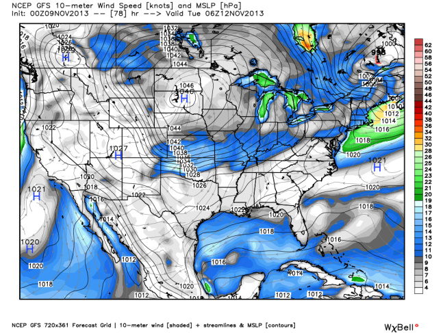
The first arctic cold front is expected to pass through much of the central and eastern U.S. by early next week. Most forecast models have a 1045hPa, or strong, surface high sweeping down the Plains, from Canada. There won’t be much moisture to work with, but a few locations in the northern Plains, Great Lakes region/Ohio Valley, and Appalachian Mountains could receive a few inches of snow behind the front. This is also where the coldest temperatures will be, with some locations dipping into the single digits for nighttime lows. The cold front will pass through Oklahoma City sometime on Monday(11/11) evening, though details are still sketchy with exact timing. In Oklahoma, temperatures will be in the lower to middle 20s as lows on Wednesday(11/13) morning.
*MSLP and 10m winds (shaded), valid Tuesday morning at midnight.*


